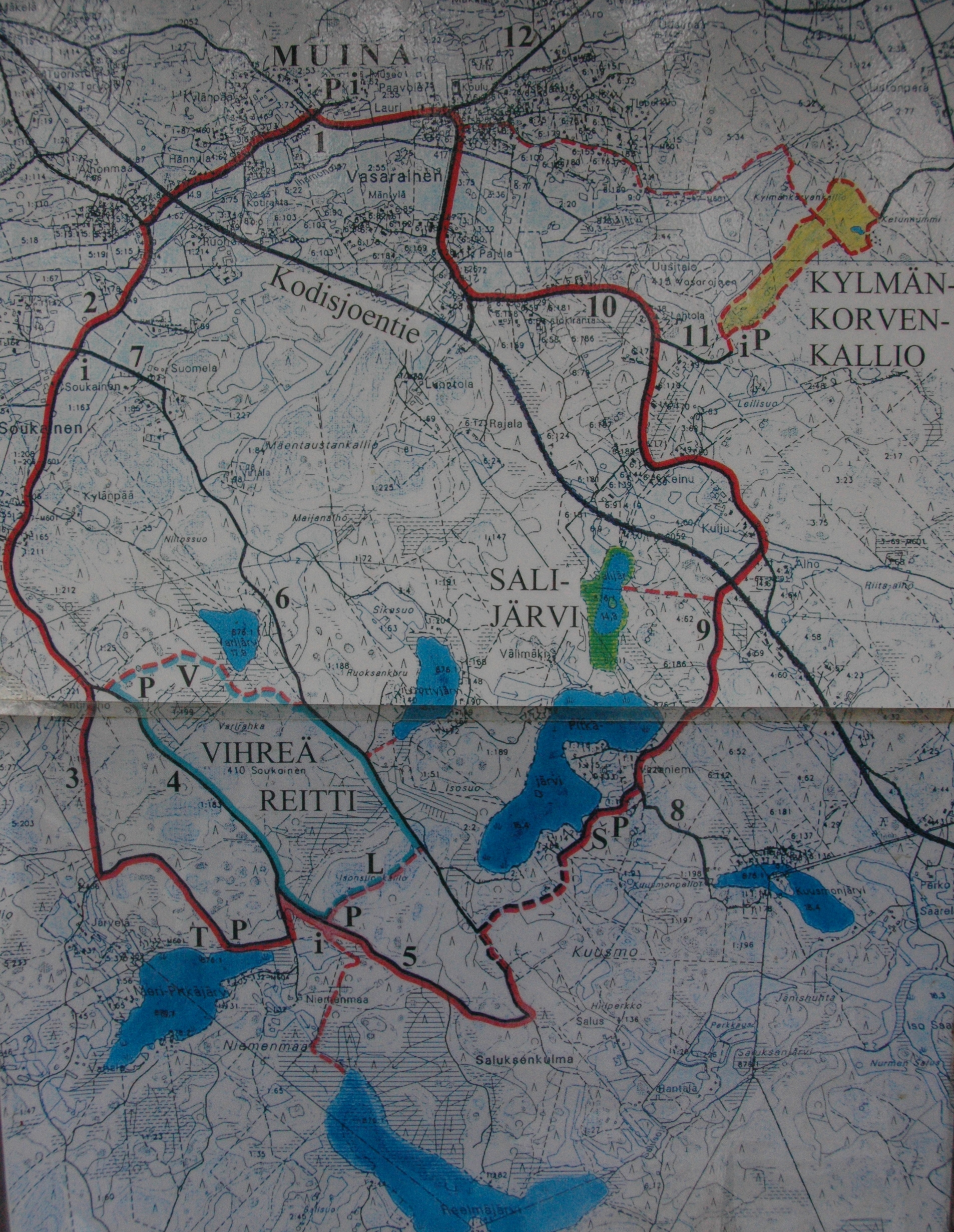
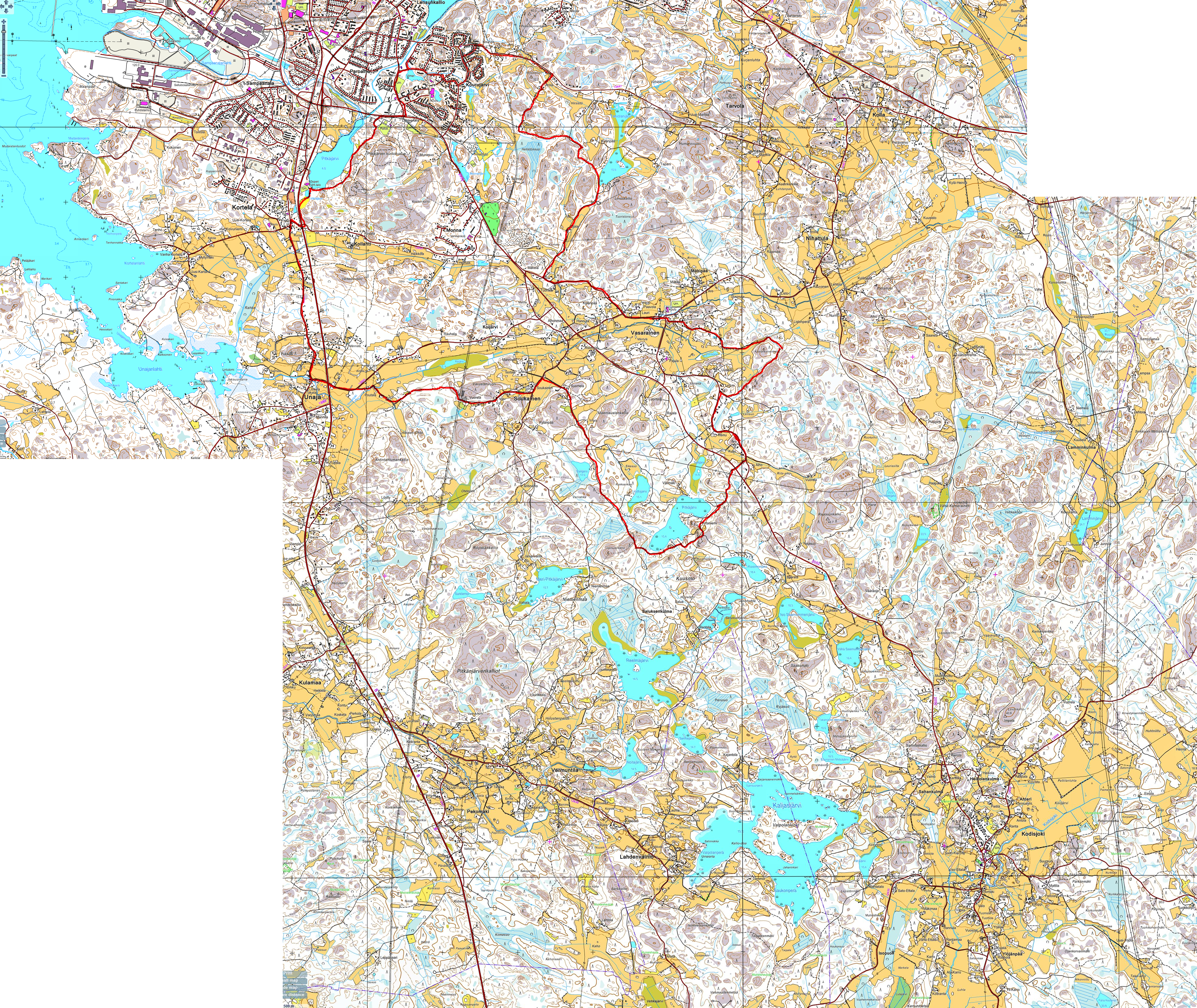
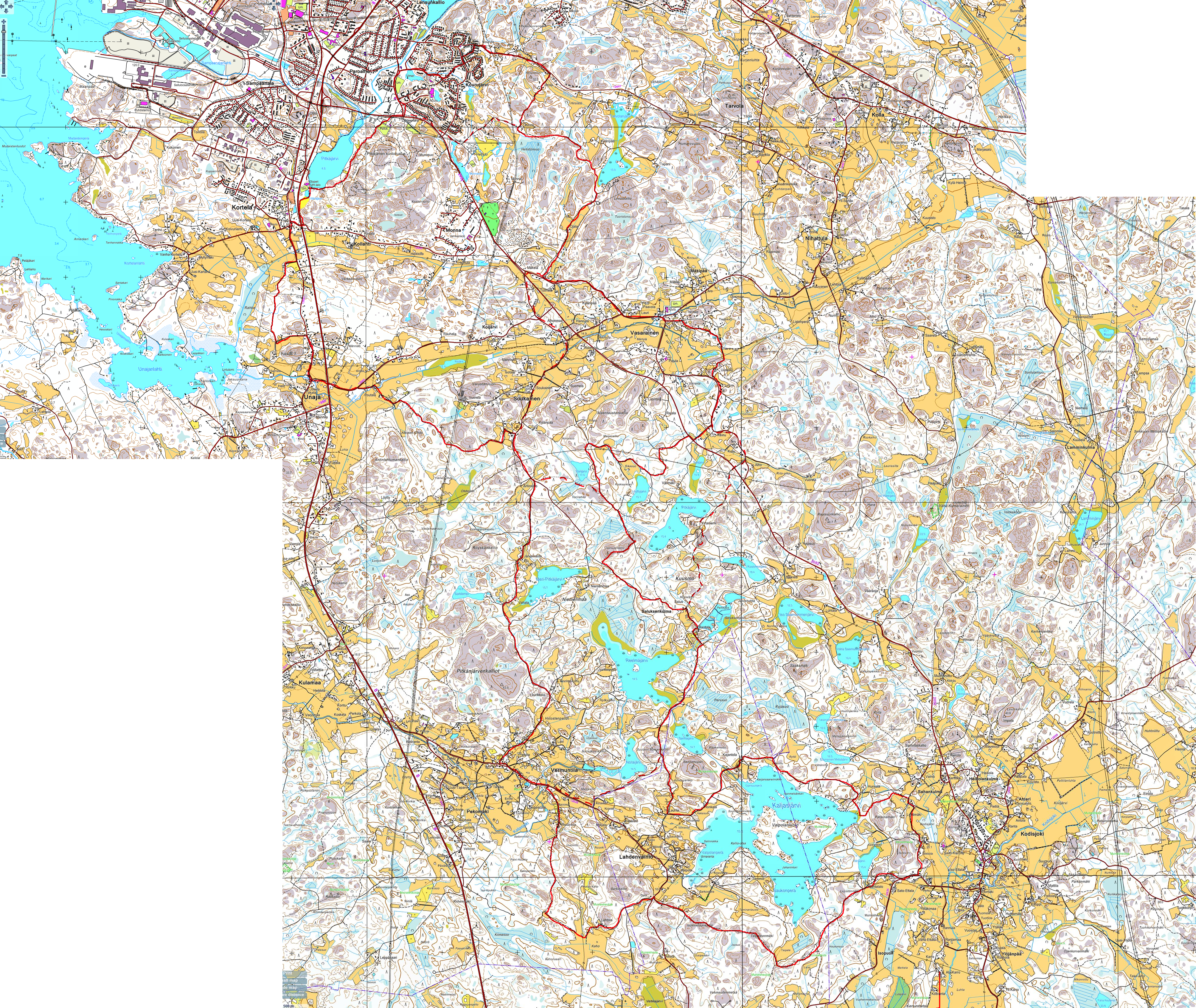
Vasarainen - Soukainen

There is a long trek in the vasarainen / soukainen area, the "7 lakes" trail.

You can park in Vasarainen to start this 3h - 12kms long trek.


The Kylmänkorvenkallion reitti trail is not well indicated. The 1:20000 map could be very useful. The parking for this short trek is located in Leilisuontie in Vasarainen. This pathways goes through some rock burrial sites similar to what can be found in Sammalahdenmäki.


There is also a restaurant in Soukainen. Search the pink house in Rustilantie in Soukainen. This may be a nice end point of a hiking day !

Google Maps content is not displayed due to your current cookie settings. Click on the cookie policy (functional) to agree to the Google Maps cookie policy and view the content. You can find out more about this in the Google Maps privacy policy.
vasarainen - soukainen simplified hiking map
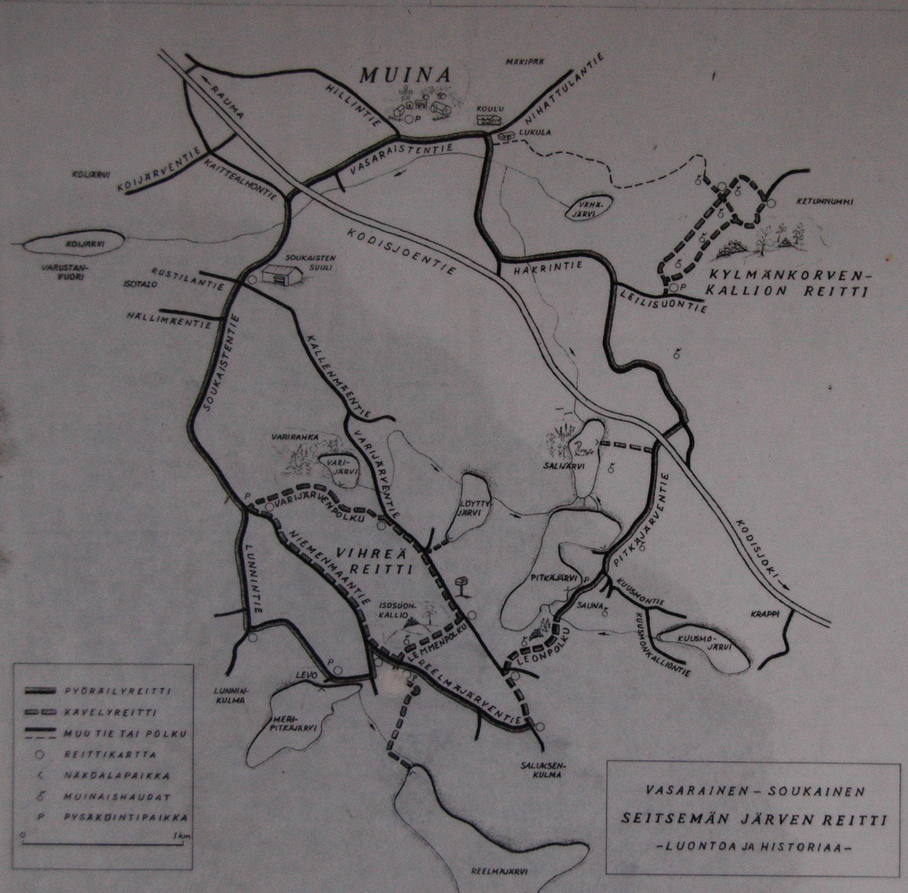
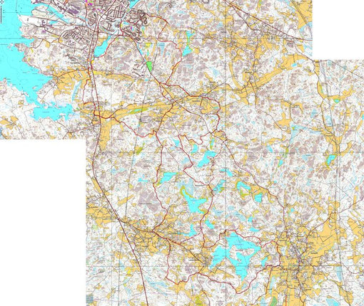
vasarainen simplified hiking map
DSC_6909.jpg
JPG Image 1.4 MB
Vasarainen hiking map
vasarainen hiking map
DSC_6907.jpg
JPG Image 2.5 MB
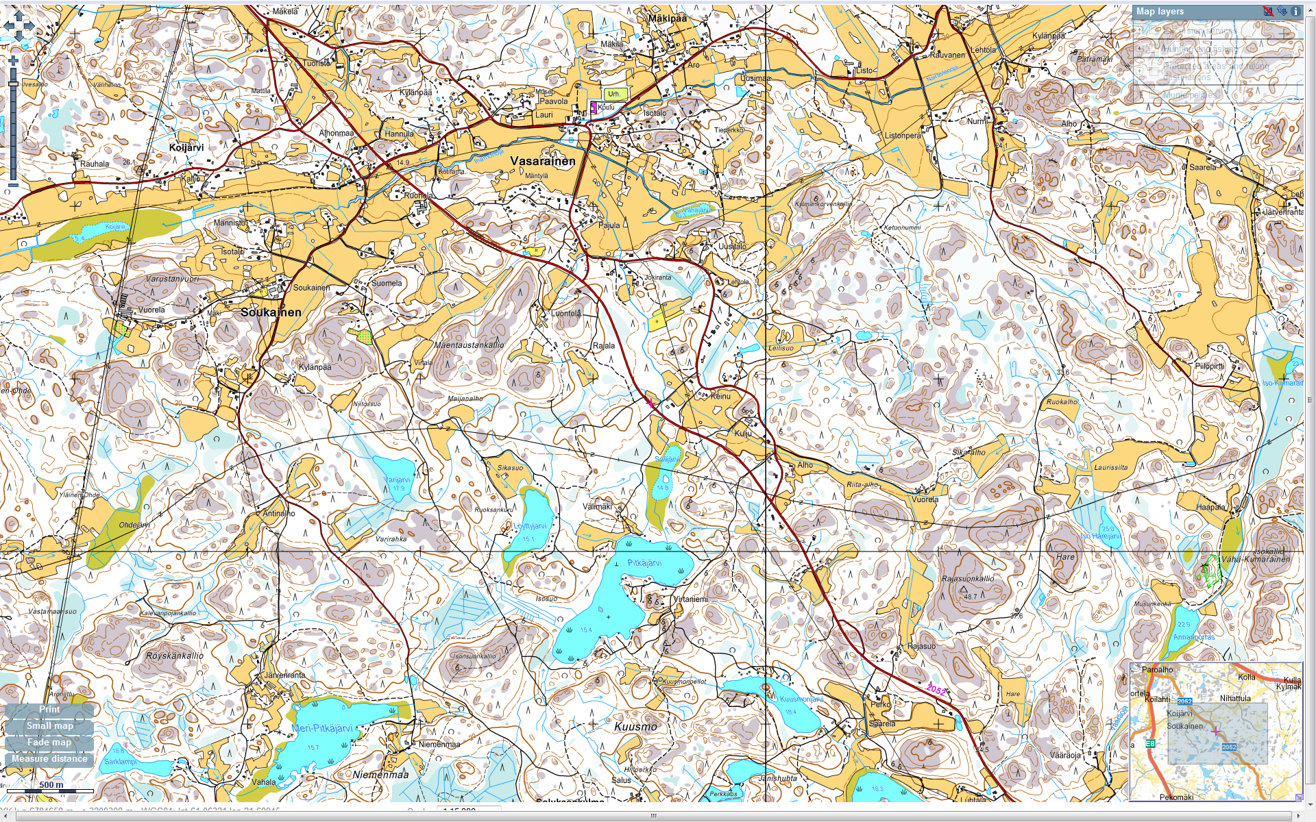
vasarainen - soukainen hiking map
vasarainen - soukainen.png
Portable Network Image Format 1.6 MB
Rauma - 7 lakes - mountainbike - 2.5h
Rauma - 7 lakes - moutainbike - 3h.png
Portable Network Image Format 24.7 MB
Rauma - 7 lakes - mountainbike - 5h
Rauma - 7 lakes - moutainbike - 5h.png
Portable Network Image Format 24.7 MB