 Rauma Outdoor
Kaarojarvi

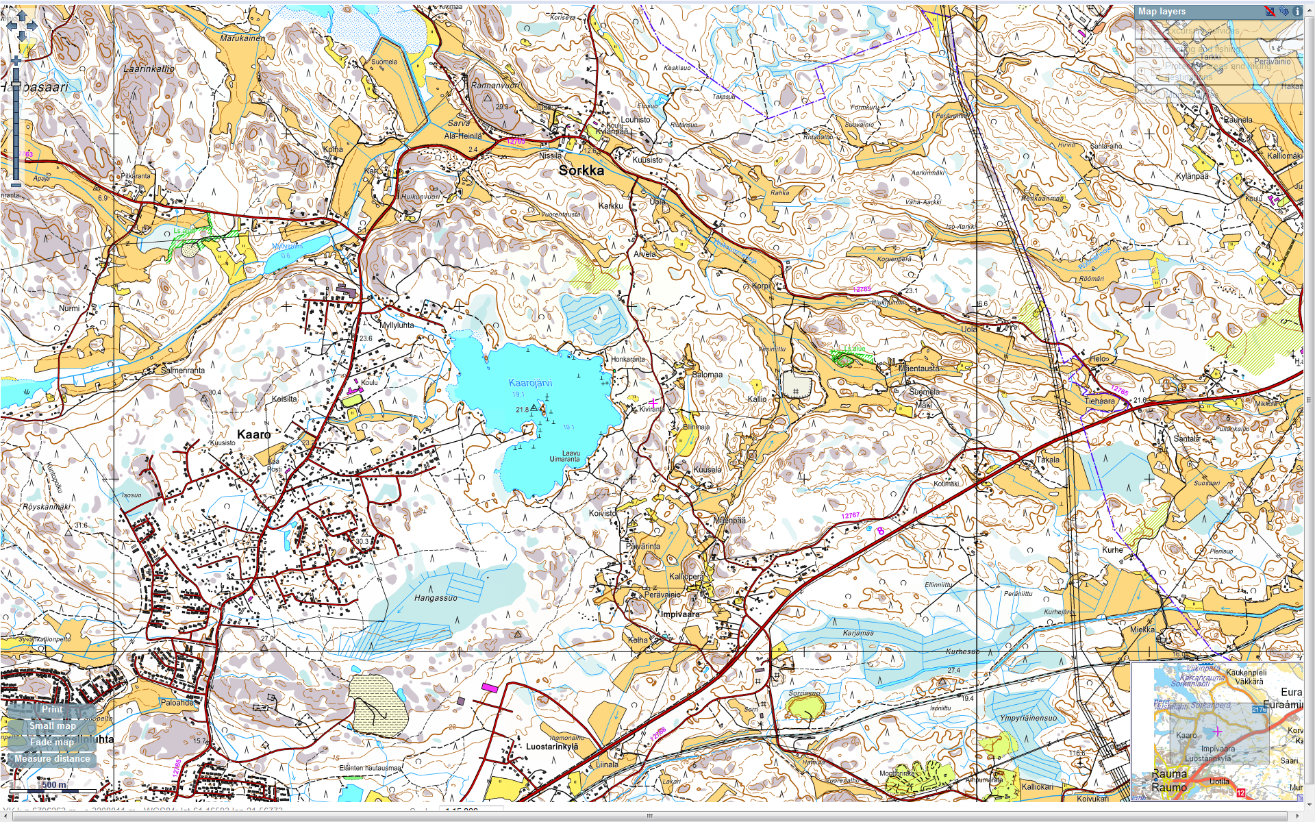
Kaarojärvi area

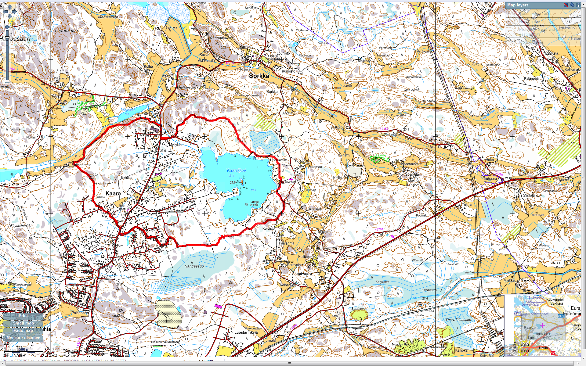
Kaarojarvi - 45min run

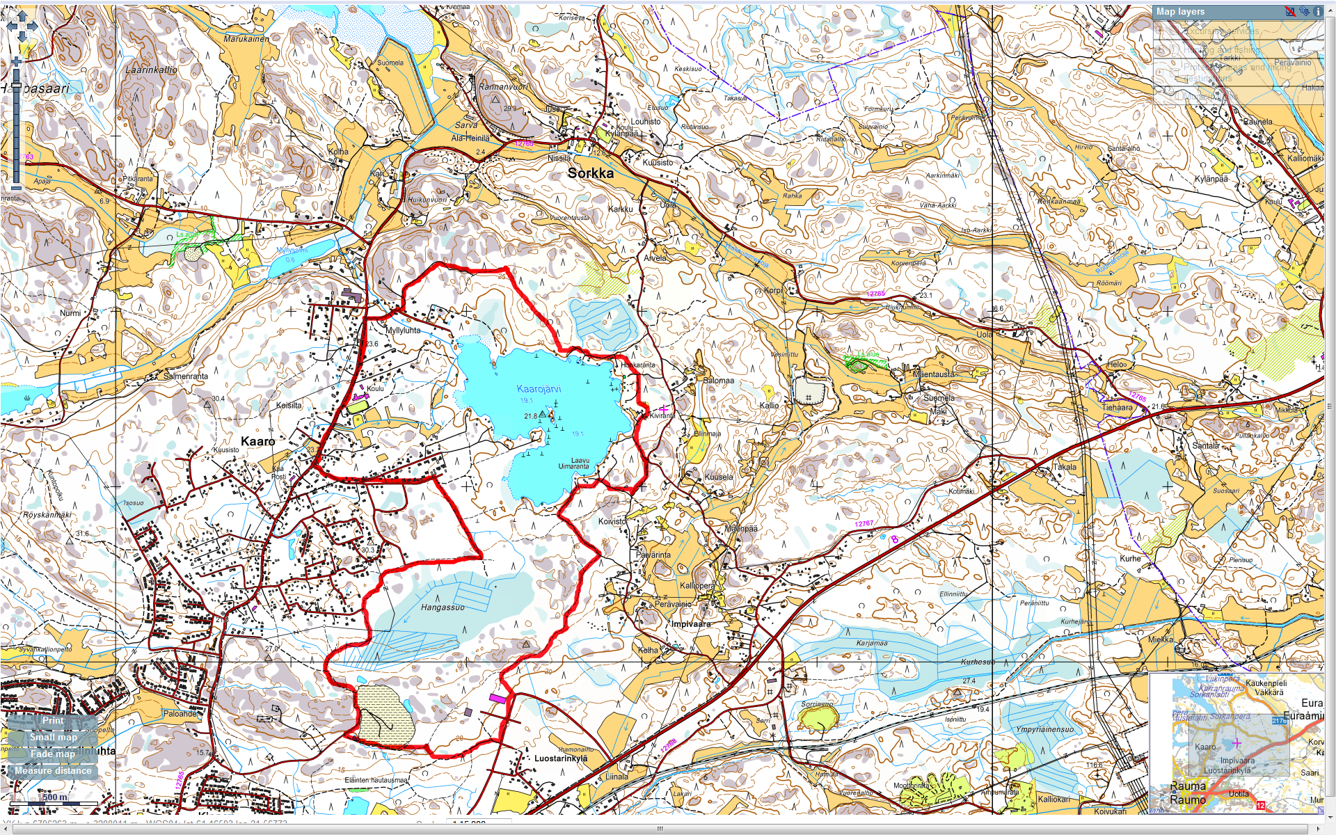
Kaarojarvi - 1h run
The pathways given below are "tricky". Compas and map are REALLY mandatory. There is no real pathway north of Kaarojärvi, you'll have to walk straitgh in the forest following your compas indication.
At night time this trails take longer that indicated.
For example, the 1h run above takes almost 1h15 when you don't know the area.
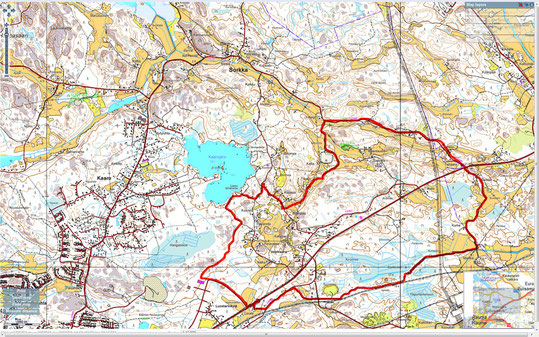
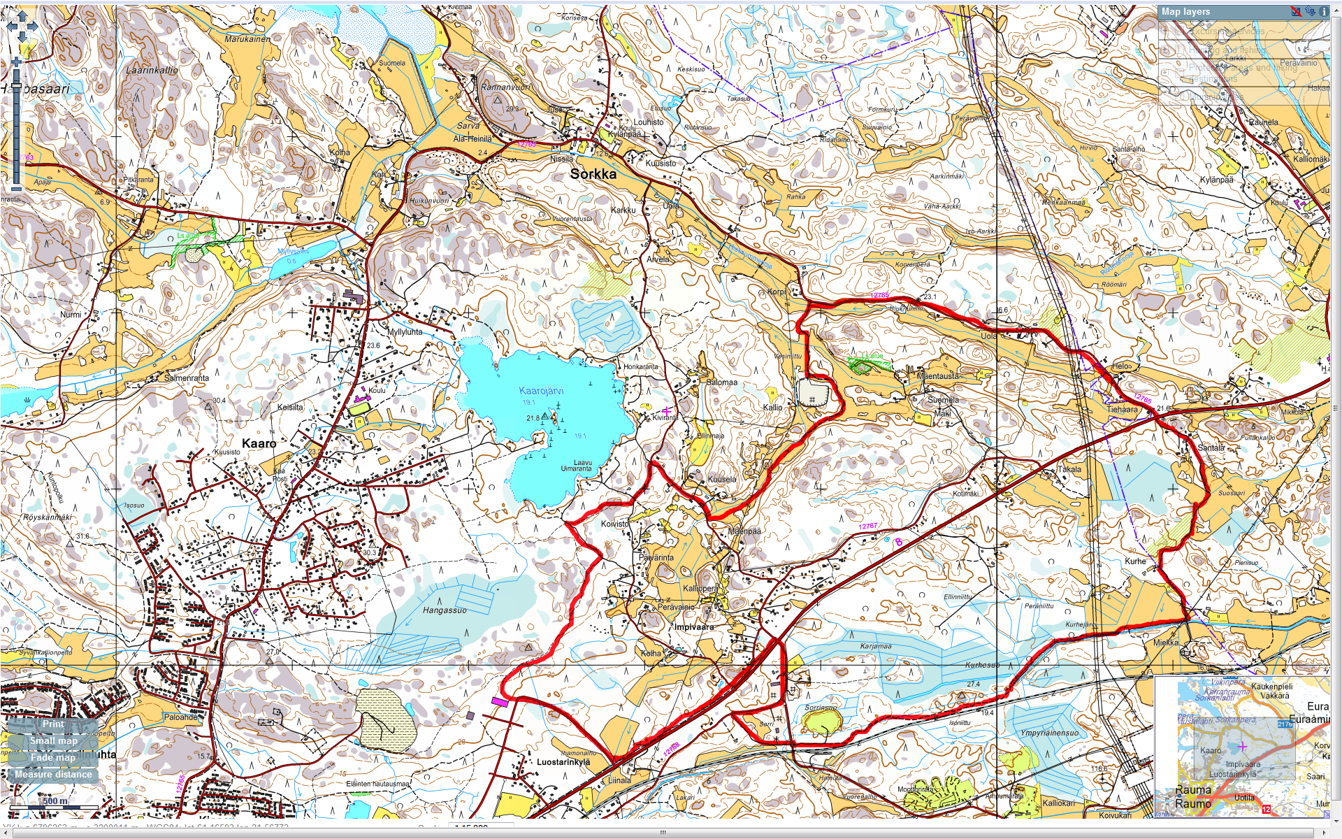
Kaarojarvi - 1h15 run
This is a fast track without too many "wild" parts. The most tricky part is along the canal in the south east of the pathway.
Dangers :
- There is a paint ball area aklong the railway in the south. It could be not advisable to follow this path when this area is "in use" ;-)
- Be careful of the cars on the Sorka road !