 Rauma Outdoor
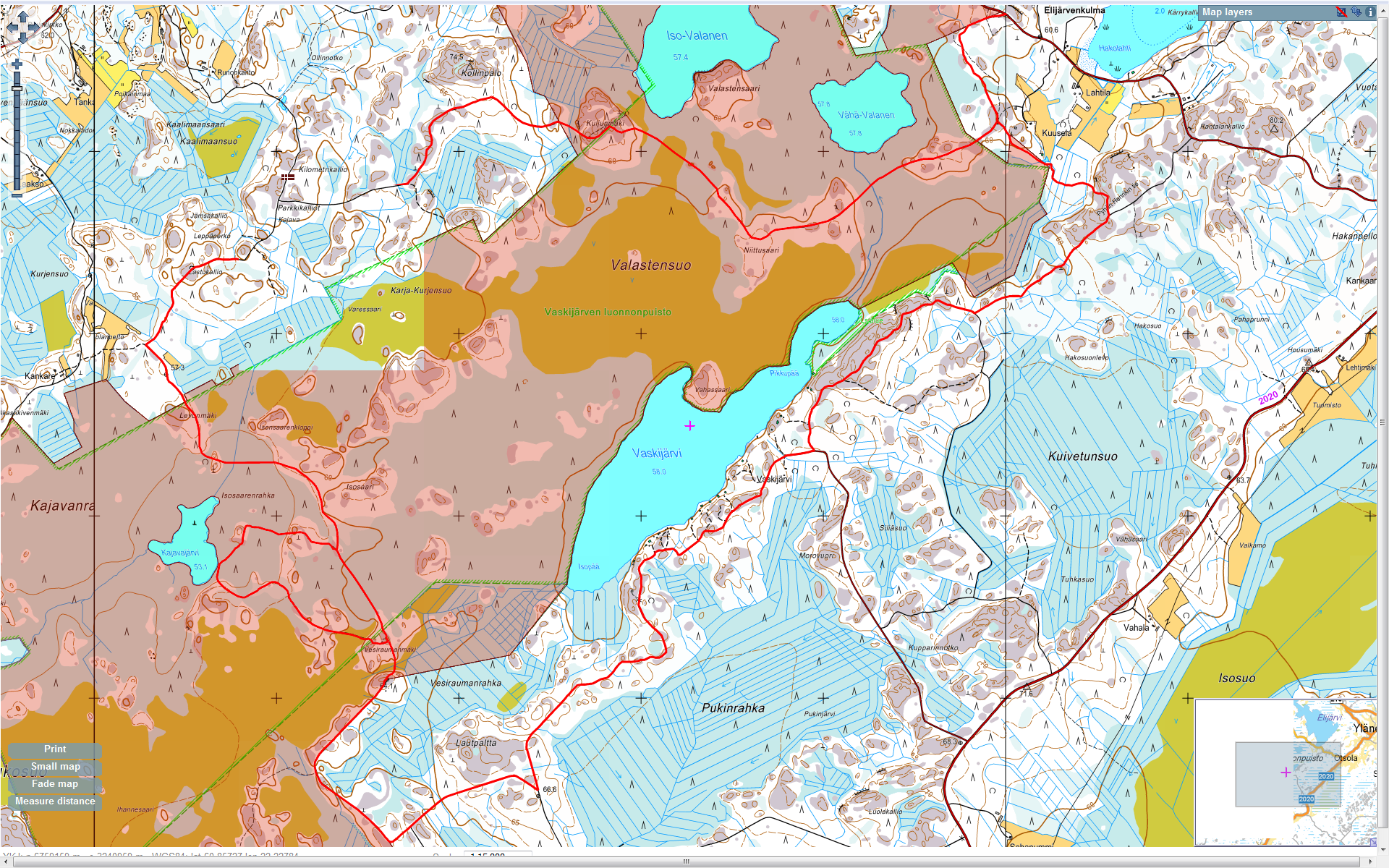
Vaskijarven
This trek is 18 kms / 4h long. It takes place in the National Park "Vaskijarven Luontopuisto". This trail is part of the Kuhankuonon trail.
The
Some Laavu (=shelters) can be found along the path.
There is a small parking in Elkijarvenkulma. From Rauma to Elkijarvenkulma the shortest way (1h15) is to drive on road 12 to Lappi, then to road 2070 to Hinnerjoki and road 210 to Koskenkyla. In Koskenkyla turn right on Lellaistentie until the parking on the left few kilometers away in Elkijarvenkulma.
Map is also available here.

Vaskijarven trek map


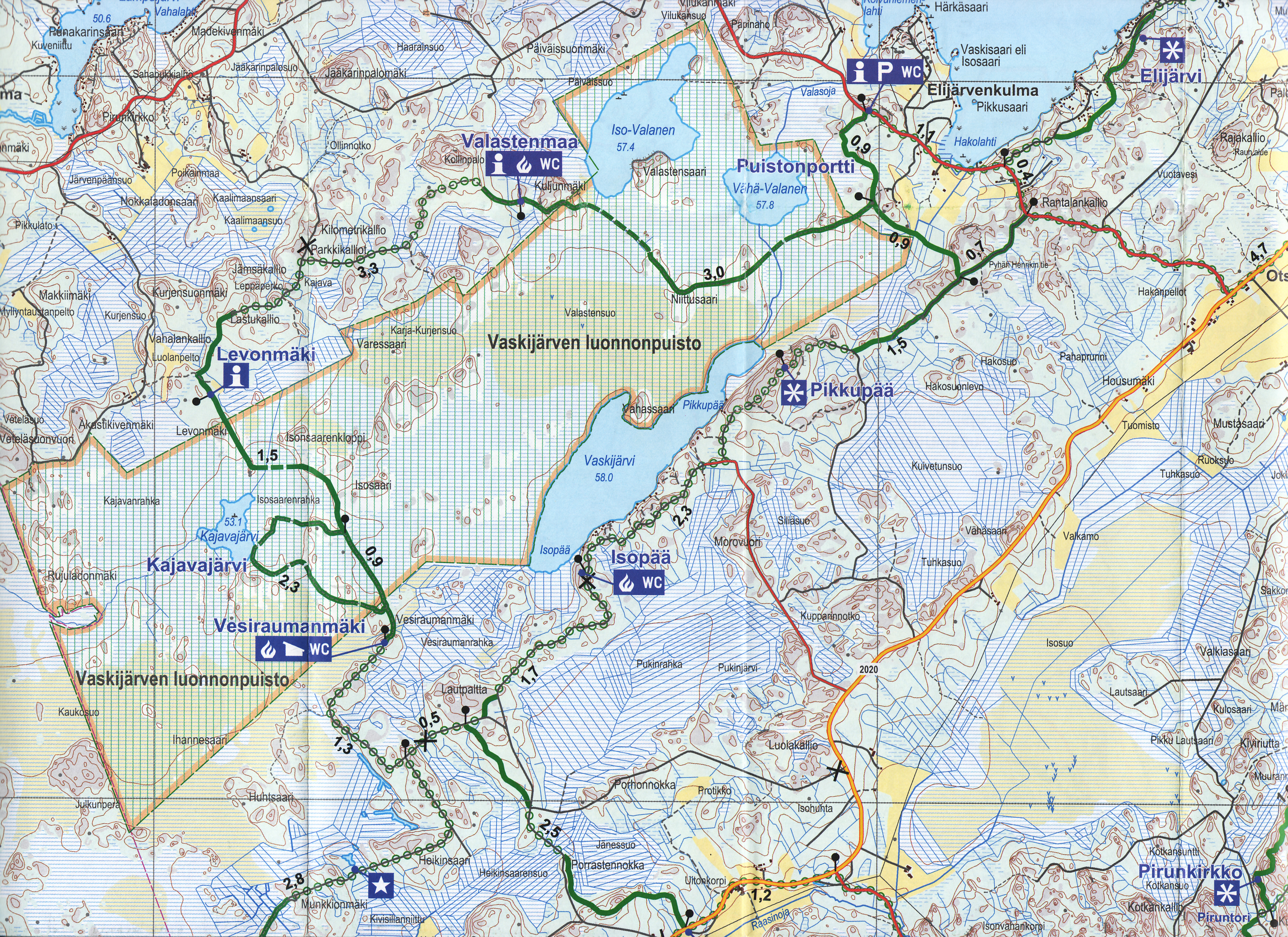
Vaskijarven Reitti